Tropical depressions, tropical storms, and hurricanes are powerful forces of nature that can significantly impact regions in their path. Tropical Depression 10, specifically, has captured attention due to its unique path and the potential risks it poses to affected areas. Understanding the path of Tropical Depression 10, how meteorologists track such systems, and what communities can do to prepare is crucial in minimizing damage and ensuring safety.
This article will explore what a tropical depression is, how the National Hurricane Center (NHC) and other meteorological agencies track these storms, and the potential path and impacts of Tropical Depression 10. Additionally, we’ll discuss how communities and individuals can stay informed and prepare effectively for tropical weather events.
Understanding Tropical Depressions and How They Form
A tropical depression is the first stage in the development of a tropical cyclone. These weather systems form over warm tropical waters, where the heat and moisture provide the fuel needed for storm development. Here, the related factors have been briefly reviewed:
Formation Conditions: Tropical depressions typically form over ocean waters with temperatures above 26.5°C (80°F). Warm water evaporates, fueling the storm, and creates low-pressure areas where winds converge.
- Wind Patterns and Rotation: As warm, moist air rises, it creates a low-pressure zone. Winds begin to rotate due to the Coriolis effect (Earth’s rotation), giving the storm its cyclonic structure.
- Stages of Development: Tropical depressions can intensify into tropical storms and hurricanes. The intensity is categorized based on wind speeds, with a tropical depression having winds less than 39 mph.
Tropical depressions are not as powerful as hurricanes but can still bring heavy rains, gusty winds, and flooding to affected areas. This potential for severe weather makes it essential to monitor their path closely.
How Meteorologists Track Tropical Depressions
Meteorologists and agencies like the National Hurricane Center (NHC) use advanced technology to track and predict the paths of tropical depressions and other tropical weather systems. A brief overview of the tools and methods used is provided here:

Satellite Imagery
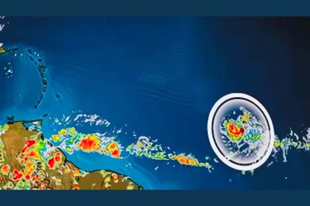
Satellites provide real-time images of weather patterns, showing cloud formation, movement, and density. Infrared satellites are particularly helpful in tracking storms at night, allowing meteorologists to see temperature differences in clouds and determine the storm’s center.
Radar Systems
Ground-based radar systems help track precipitation and wind patterns. Radar can show the intensity and location of rainfall associated with the storm, giving a clearer picture of which areas are likely to be affected.
Reconnaissance Aircraft
Specially equipped aircraft, often called “hurricane hunters,” fly into tropical depressions and other storms to collect data. These planes measure wind speed, temperature, pressure, and humidity at different altitudes, providing critical information about the storm’s strength and structure.
Computer Models and Forecasts
Meteorologists use computer models to predict the path and intensity of tropical systems. These models, such as the Global Forecast System (GFS) and the European Centre for Medium-Range Weather Forecasts (ECMWF), simulate the atmosphere based on current conditions and provide forecasted paths. Meteorologists compare multiple models to assess the most likely path for Tropical Depression 10.
Tracking technology has improved significantly, allowing meteorologists to provide accurate and timely warnings that save lives and minimize property damage.
The Path of Tropical Depression 10
Environmental conditions, surrounding weather systems, and sea temperatures determine Tropical Depression 10’s path. Here’s an in-depth look at how meteorologists forecast its movement:
Initial Formation and Movement
- Formation Location: Tropical depressions often form over the Atlantic or Pacific oceans. In this case, Tropical Depression 10 formed in the Atlantic.
- Direction of Movement: Tropical depressions generally follow trade winds, moving westward across the sea. However, they can shift northward or southward depending on surrounding weather systems.
Factors Influencing Path
- High-Pressure Systems: High-pressure systems can steer tropical depressions, pushing them towards land or out to sea.
- Low-pressure troughs can draw tropical depressions northward, potentially toward coastal regions.
- Wind Shear: Wind shear refers to a change in wind speed and direction with altitude. High wind shear can weaken a storm or disrupt its path, while low wind shear can allow it to strengthen and stay organized.
Predicted Path and Landfall Possibilities

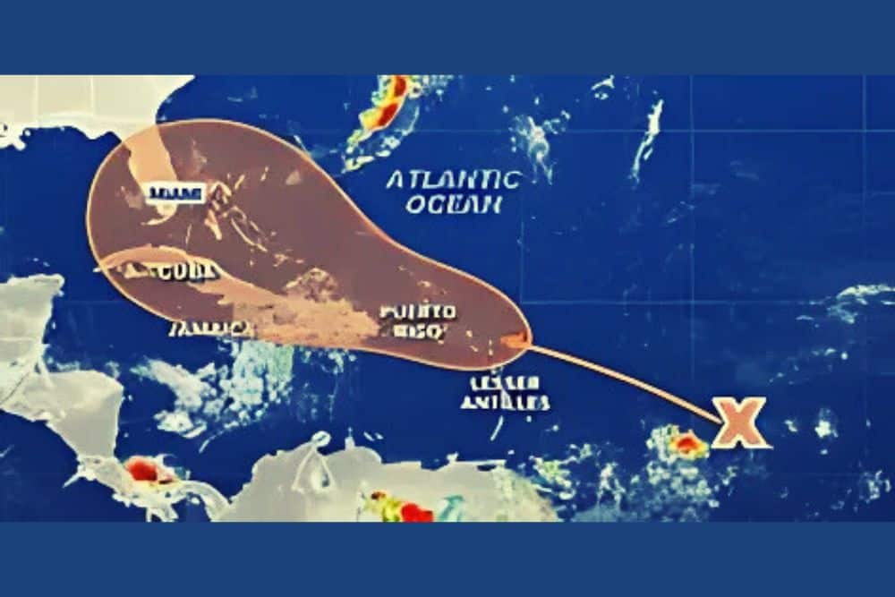
Meteorologists create “cones of uncertainty” to depict the most likely path of a tropical depression. For Tropical Depression 10, the cone may cover regions along the U.S. East Coast, the Gulf of Mexico, or the Caribbean, depending on current weather models. The predicted path is updated regularly, giving communities time to prepare as the storm approaches.
Potential Impacts of Tropical Depression 10
Even though tropical depressions are weaker than hurricanes, they can still cause significant damage. A review of the potential impacts is provided:
Heavy Rain and Flooding
One of the main dangers of a tropical depression is heavy rainfall, which can lead to flash flooding, particularly in low-lying areas. Coastal and inland communities along the predicted path of Tropical Depression 10 should be prepared for flood risks, as even a weak storm can drop substantial amounts of rain.
Storm Surge in Coastal Areas
While storm surges are more familiar with hurricanes, tropical depressions moving slowly near the coast can cause water levels to rise, especially near high tide. Coastal flooding can occur, and residents should know this potential hazard.
Wind Damage
Although the winds in a tropical depression are not as strong as in hurricanes, they can still reach up to 39 mph, enough to cause minor damage to trees, power lines, and weaker structures. Winds can also create dangerous driving conditions, and residents should avoid unnecessary travel.
Tornadoes
Some tropical depressions spawn tornadoes, particularly in outer rainbands. Although tornadoes formed by tropical systems are generally weak, they can still damage homes, vehicles, and other structures in their path. Residents in areas expecting landfall or nearby should remain alert to tornado warnings.
How to Prepare for Tropical Depression 10

Preparation is crucial in minimizing the risks associated with tropical depressions. Here are the actions that individuals and communities can take:
Stay Informed
- Monitor Weather Updates: Regularly check updates from trusted sources, such as the National Hurricane Center, NOAA, or local meteorologists.
- Understand Warning Levels: Familiarize yourself with the difference between a tropical depression warning and a tropical storm or hurricane warning.
Create an Emergency Plan
- Evacuation Routes: Identify evacuation routes if you need to leave your area quickly. Ensure that all family members are informed about the plan.
- Family Communication Plan: Set up a way to stay in contact with family members if you become separated.
- Designate a Safe Room: Choose a safe room away from windows where you can shelter in place during severe weather.
Assemble a Disaster Kit
- Basic Supplies: Include non-perishable food, water, medications, flashlight, and a first-aid kit.
- Personal Items: Ensure you have important documents, cash, and any specific items for family members (such as baby supplies or pet food).
- Backup Power: Prepare a generator or other backup power source to power essential devices.
Secure Your Home
- Outdoor Objects: Secure outdoor furniture, decorations, and other items that could become projectiles in strong winds.
- Check Gutters and Drains: Clear gutters and drains to prevent water backup and reduce the risk of flooding.
- Board Windows: If Tropical Depression 10 is expected to bring strong winds, consider boarding up windows for added protection.
Community and Government Response
Local governments and community organizations are critical in preparing for and responding to tropical depressions. Here’s how communities work together:
- Evacuation Orders: Officials may issue evacuation orders for areas at risk of severe flooding or storm surge. It’s essential to follow these orders promptly.
- Emergency Shelters: Many communities set up shelters for residents who need a safe place to stay.
- Communication and Alerts: Local governments use radio, television, and online alerts to communicate updates and instructions.
Community preparation efforts are crucial for minimizing the impact of tropical weather systems and ensuring the safety of all residents.
Conclusion
Like all tropical weather systems, Tropical Depression 10 requires careful monitoring and preparation. By understanding the storm’s path and potential impacts, communities and individuals can take proactive measures to stay safe. Tropical depressions may not be as intense as hurricanes, but they can still bring heavy rain, flooding, and other hazardous conditions that disrupt daily life.
As the storm progresses, staying informed, preparing your home, and following official guidance can make all the difference. Communities’ resilience in the face of such weather events is built on preparation and awareness, ensuring that recovery can begin promptly and smoothly when the storm passes.


Leave a Reply